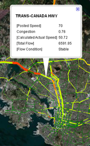
KMZ files are zipped Keyhole Markup Language (KML) files. KML is
a file format used to display customized geographic data and can be
viewed in an Earth browser, such as Google Earth, Google Maps, and
Google Maps for mobile.
Use of spatial data from this site is subject to the following:
The Capital Regional District does not make any guarantee,
expressed or implied, regarding the accuracy of data or fitness for
a particular purpose, and does not assume liability or
responsibility for the accuracy, content, completeness, quality or
usefulness of any data. The Capital Regional District disclaims all
liability of any kind whatsoever arising out of the use of, or
inability to use, this data. The Capital Regional District assumes
no responsibility for damages, losses, business interruption or
expenses incurred as a result of using this product or
service.
Distribution
The Capital Regional District does not permit the user to rent,
sell, distribute, transfer, or grant any rights to this product or
service, in whole or in part, to another person or
organization.